Richford Area Cellular Coverage Charts
|
The author of this article can be contacted at
richard@heurtley.com.
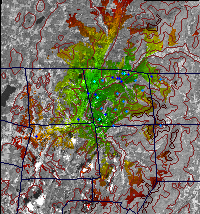
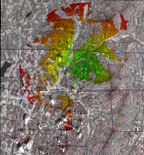
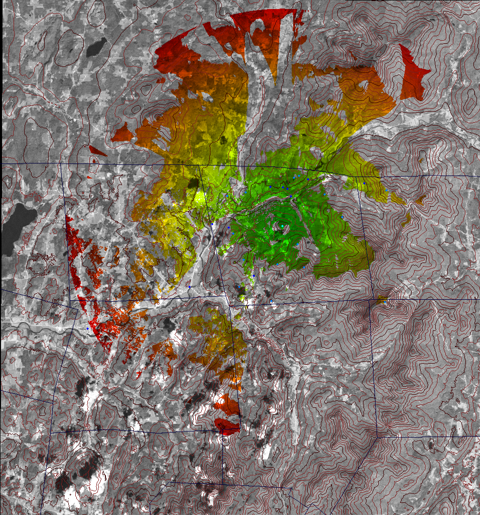
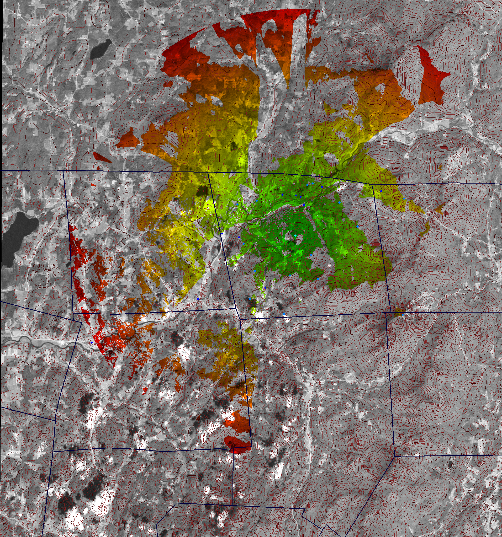
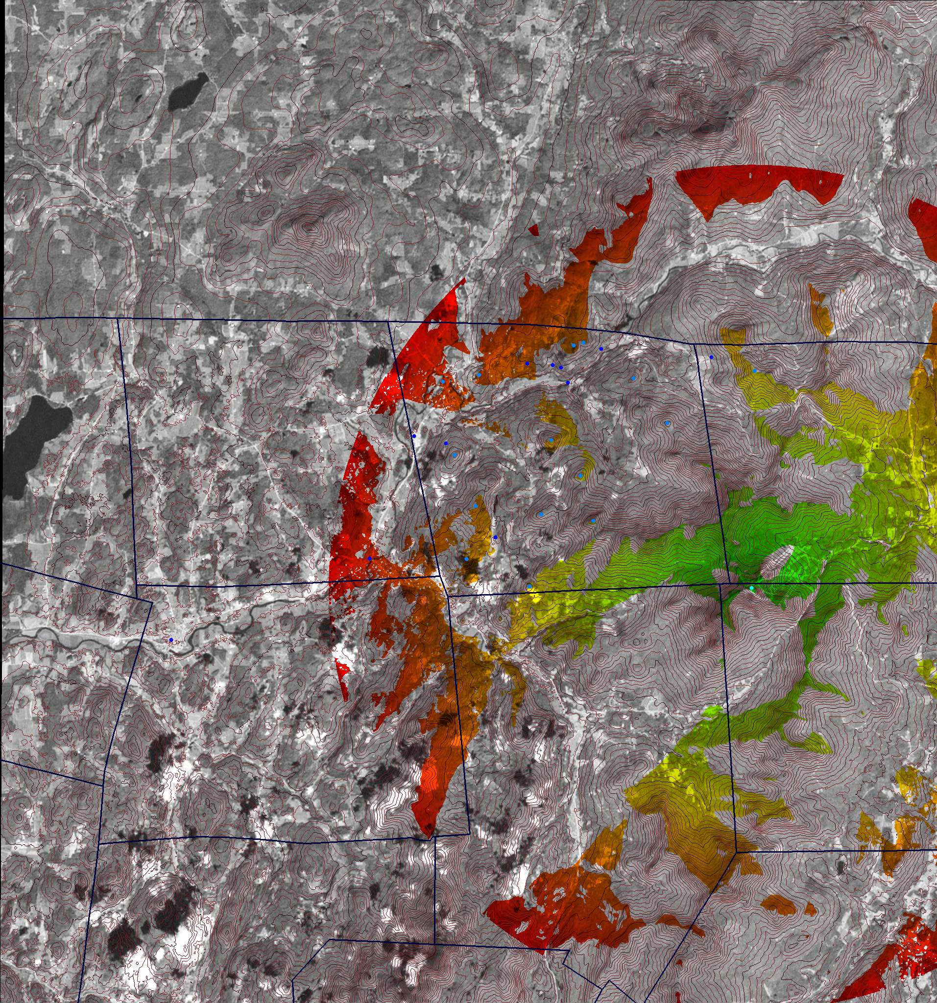
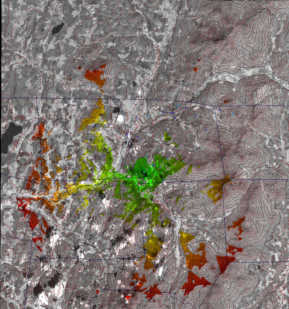
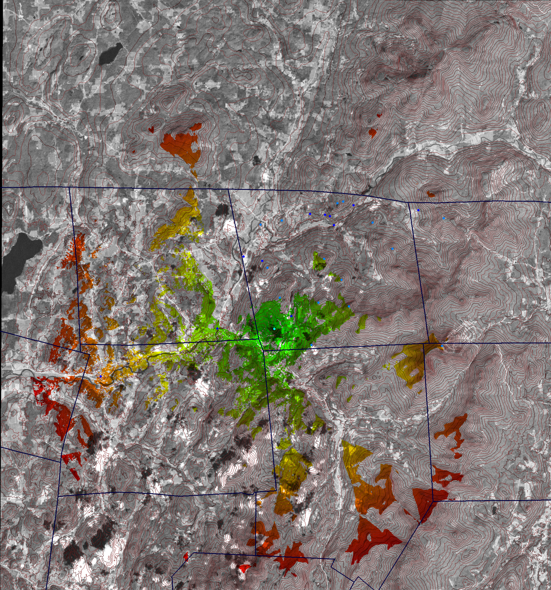
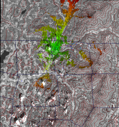
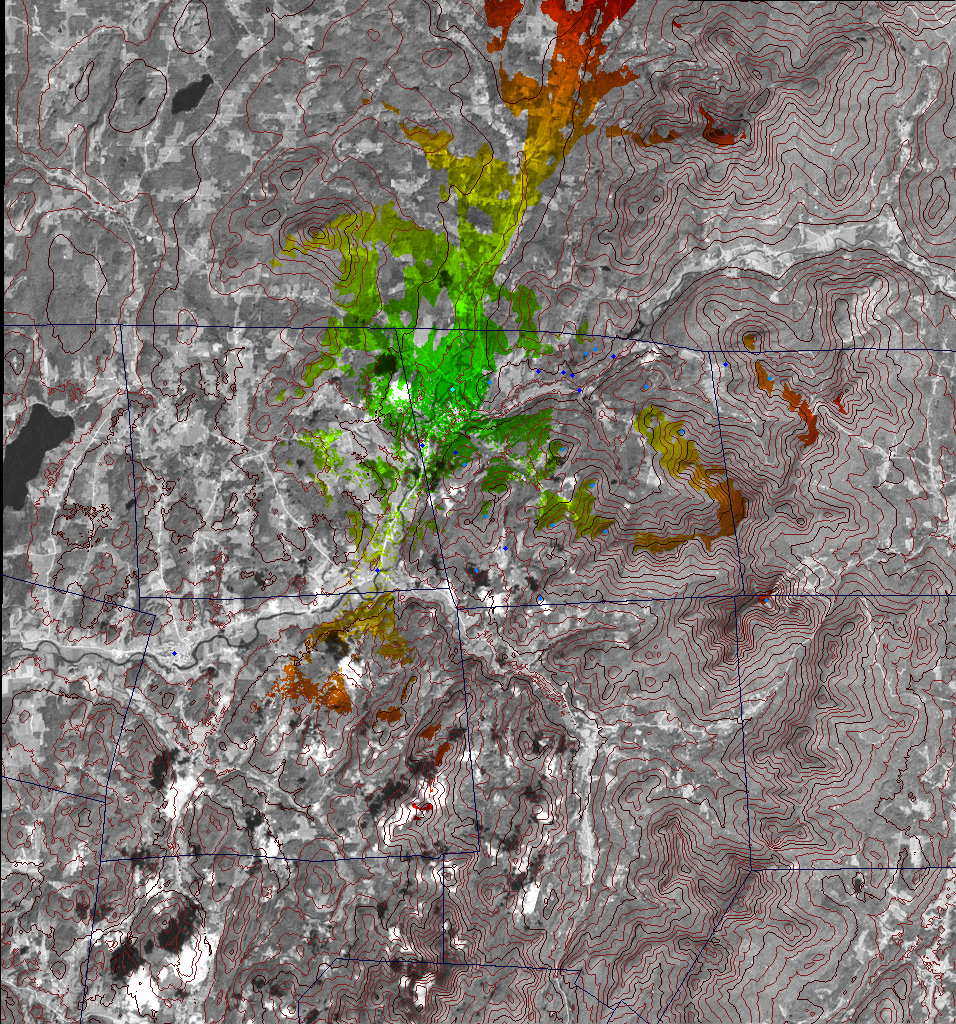
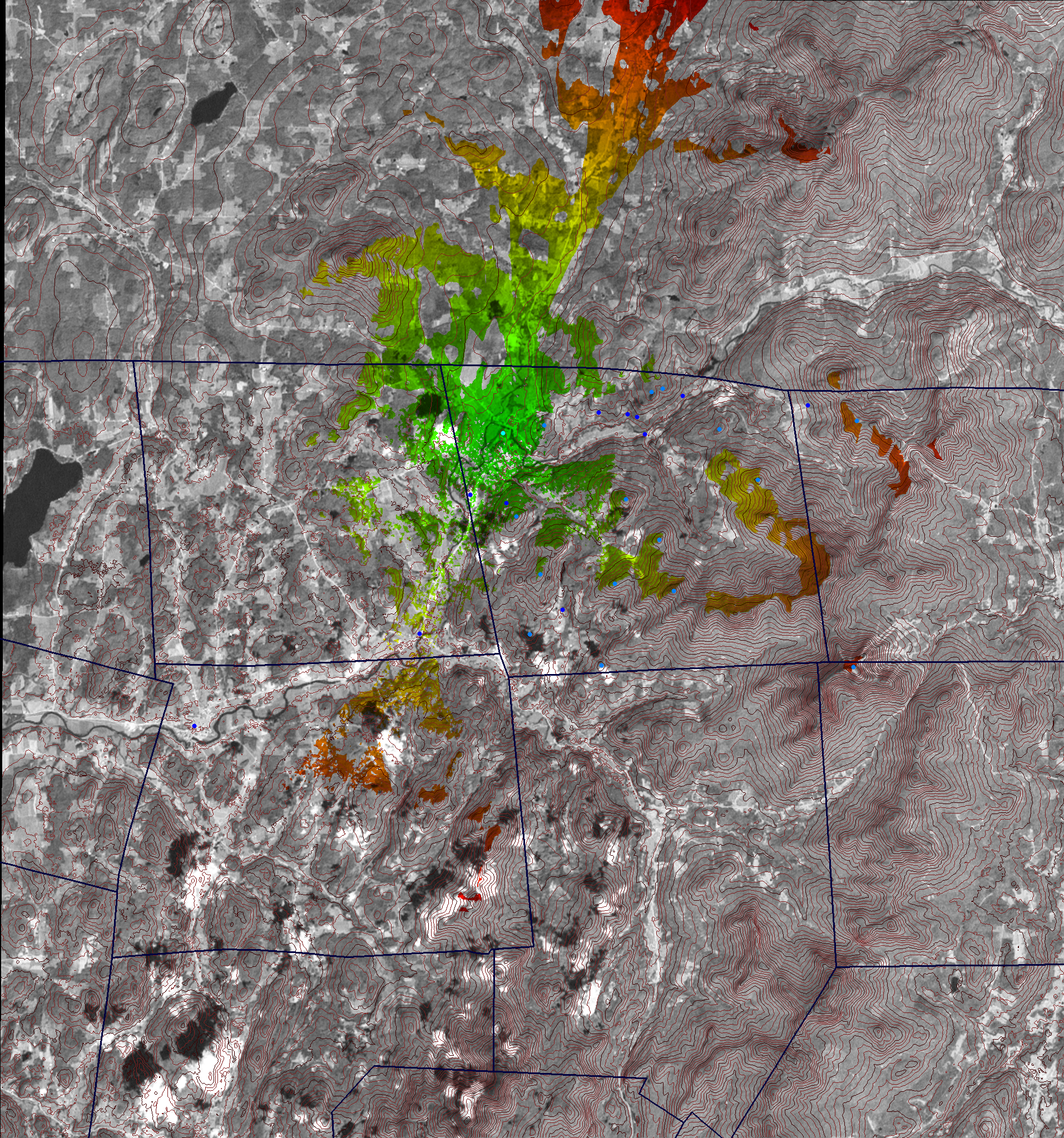
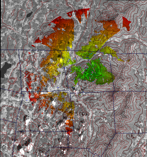
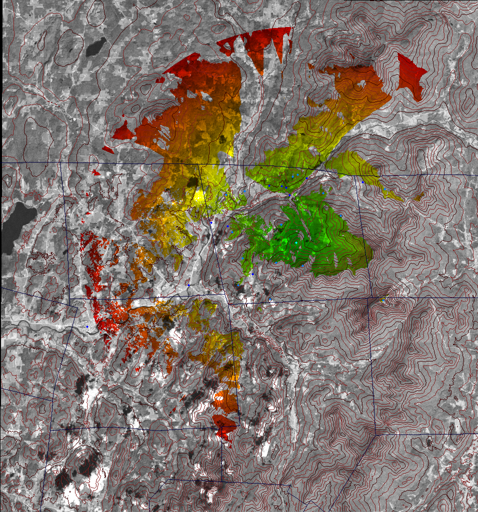
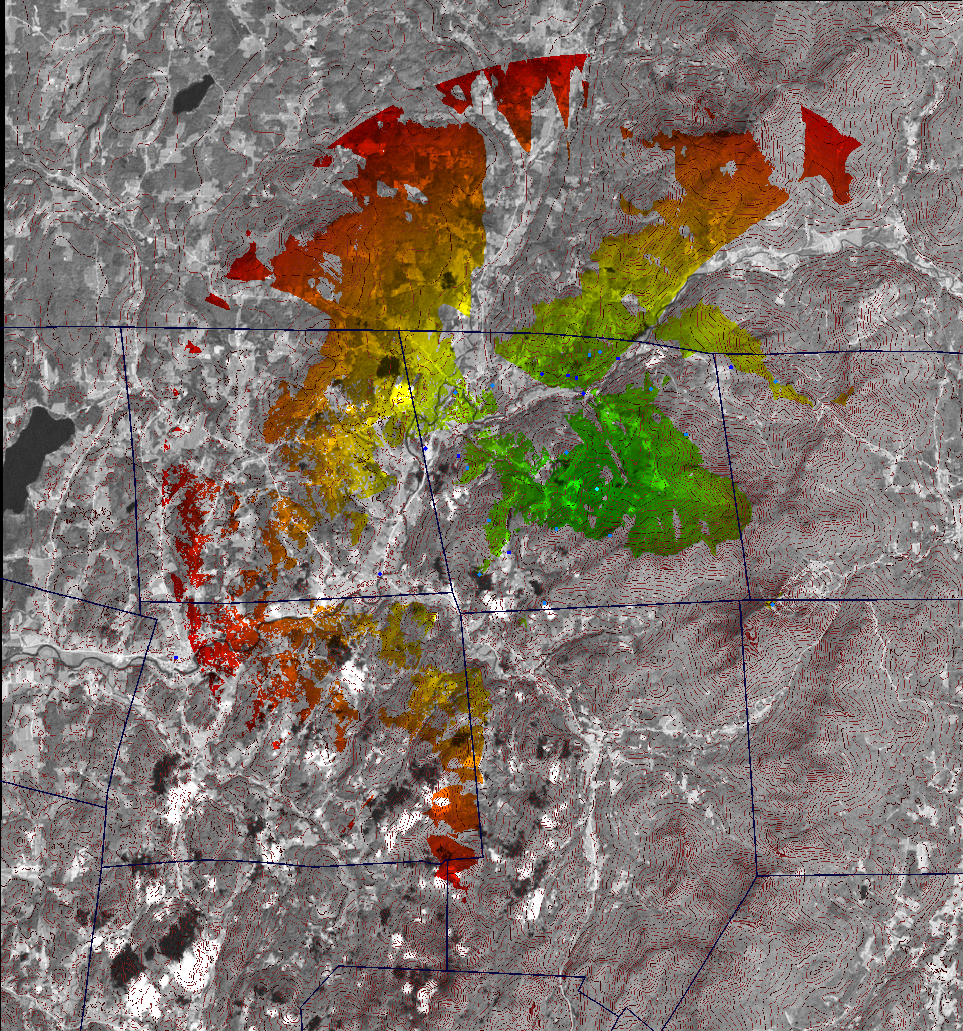
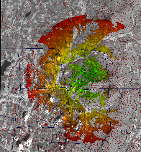
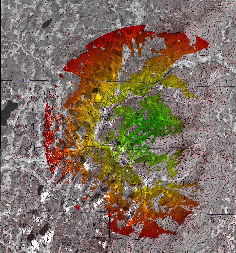
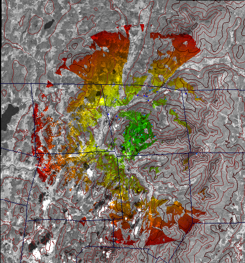
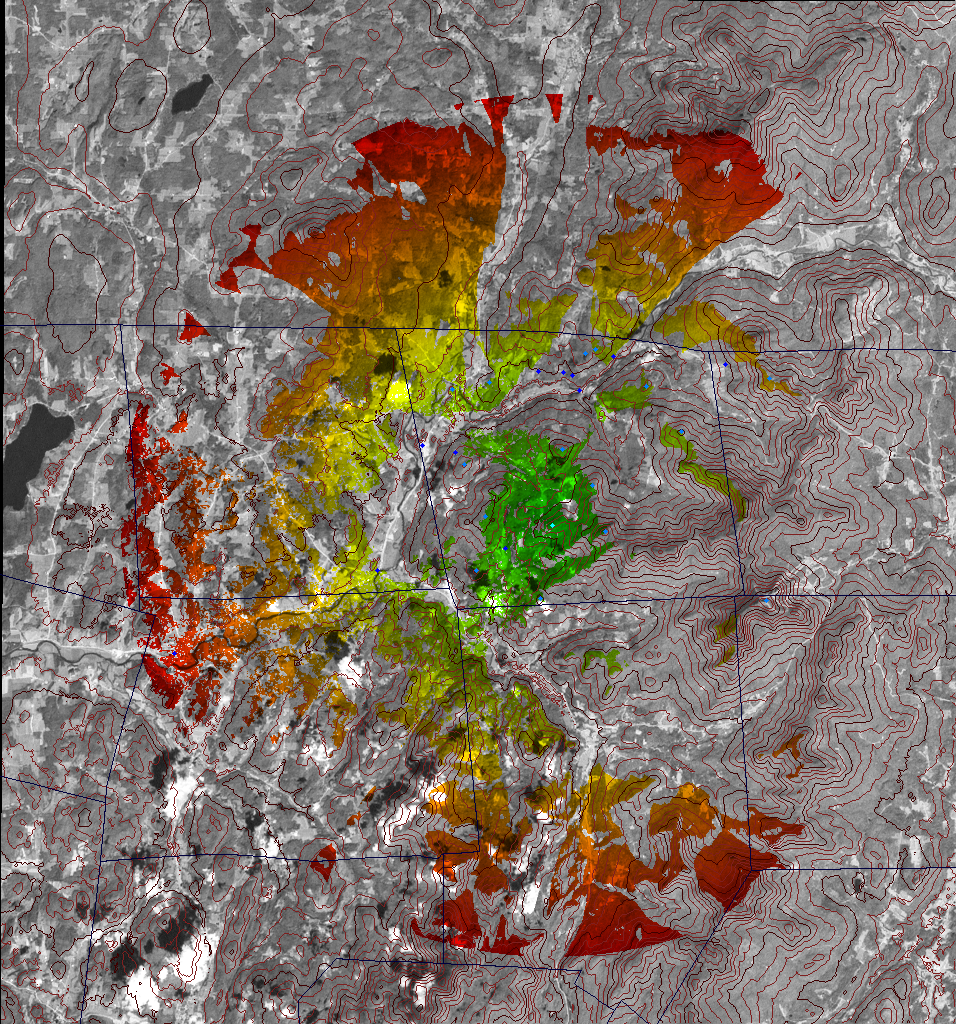
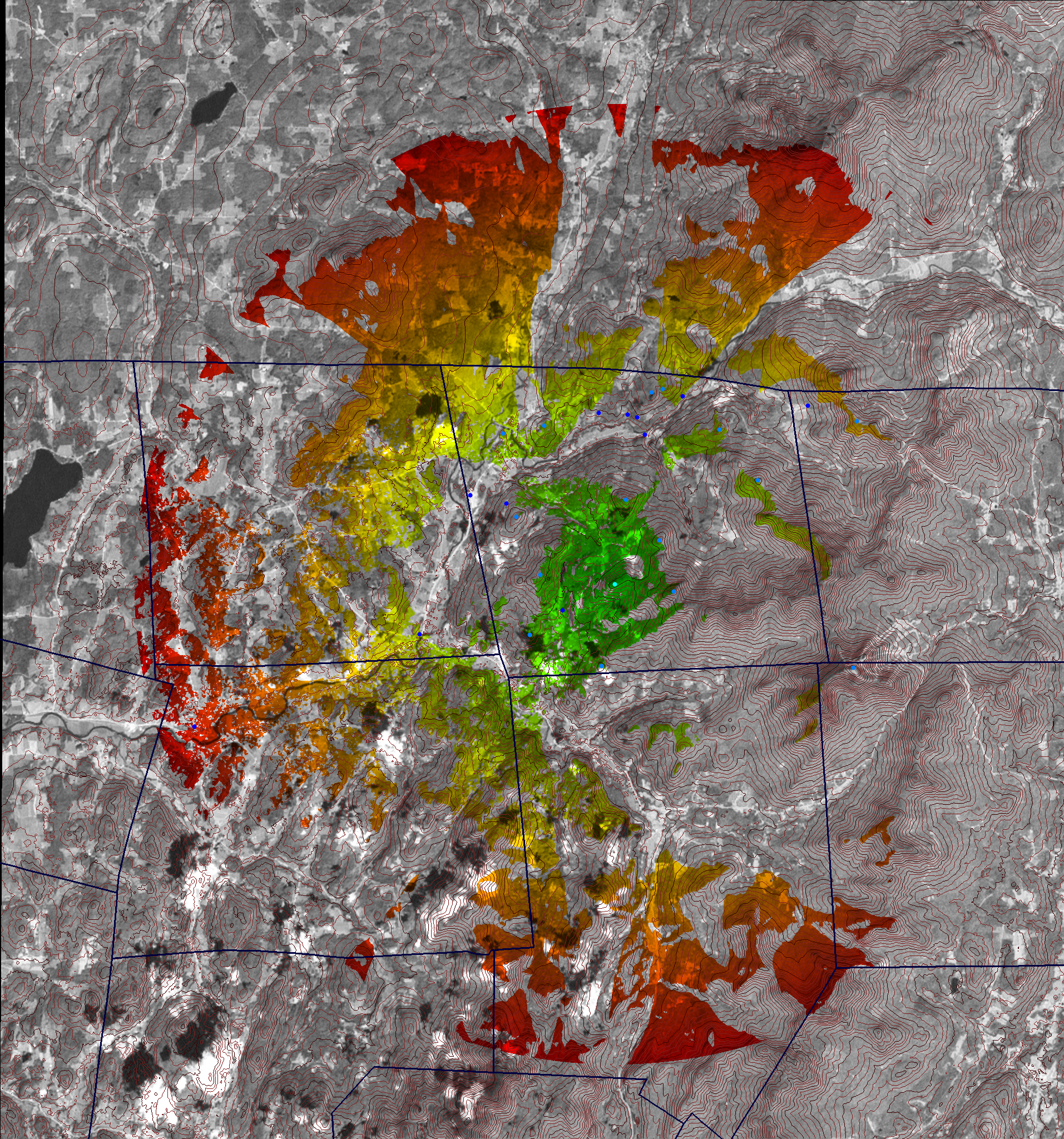
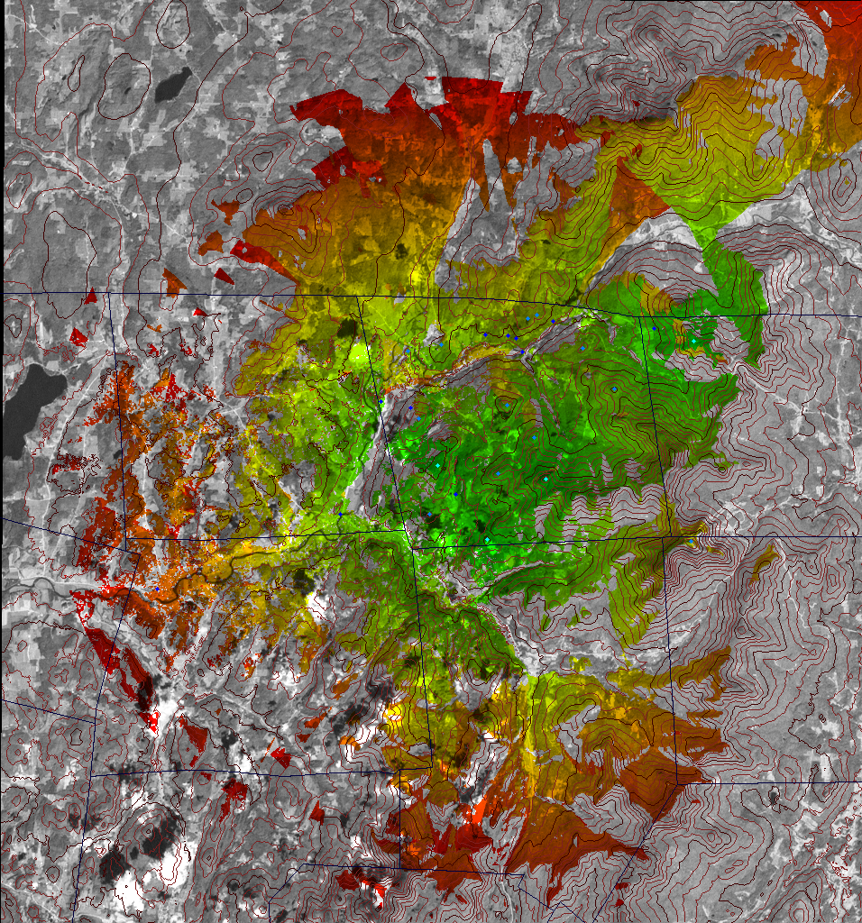
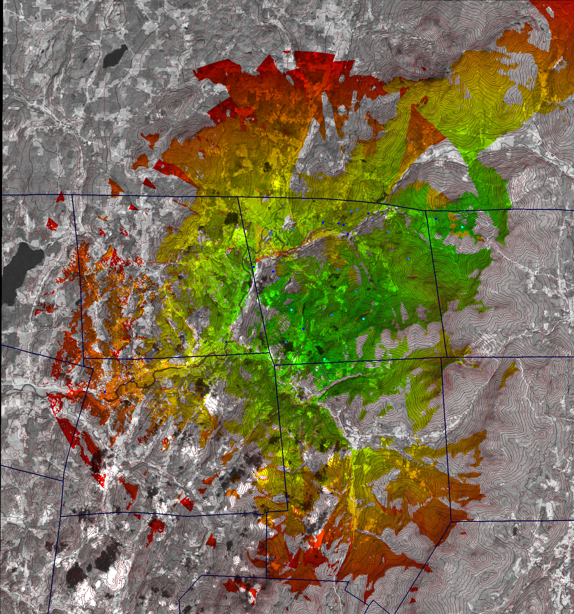
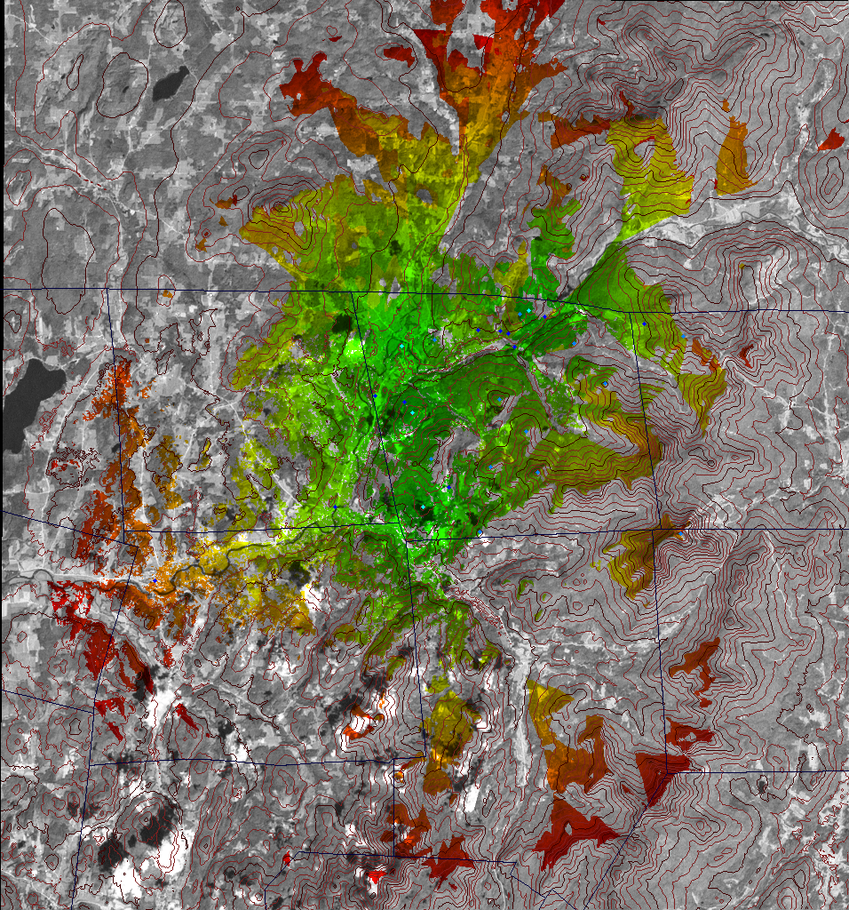
Cellular telephone coverage in Richford, Vermont is spotty at best. The cell providers' main antennas are on Jay Peak, the highest mountain in the area, but the mountainous Richford Village watershed area blocks the signal for most of Richford. I wrote a computer program to calculate line-of-sight coverage areas for different potential antenna locations in and around Richford. The program corrects for earth curvature and atmospheric refraction with a K value of 4/3. The elevation data and background imagery came from the U.S. Geological Survey:
The town boundaries came from the Vermont Center for Geographic Information:
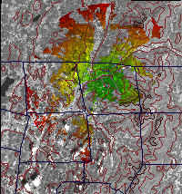
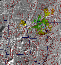
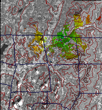
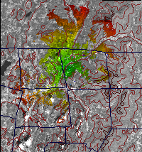
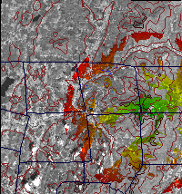
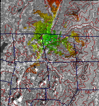
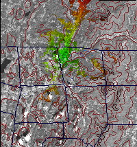
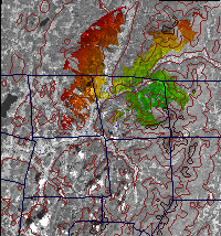
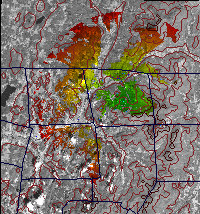
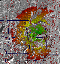
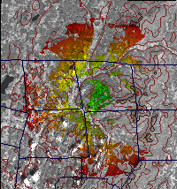
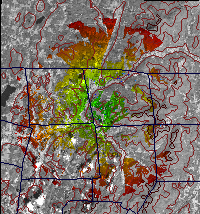
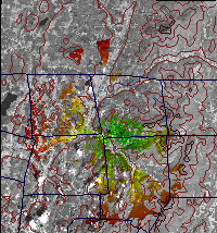
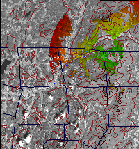
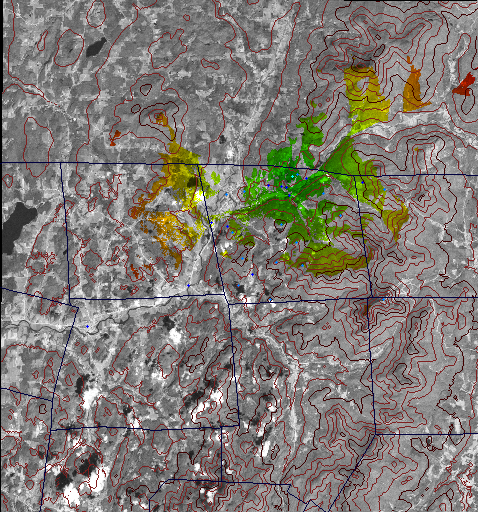
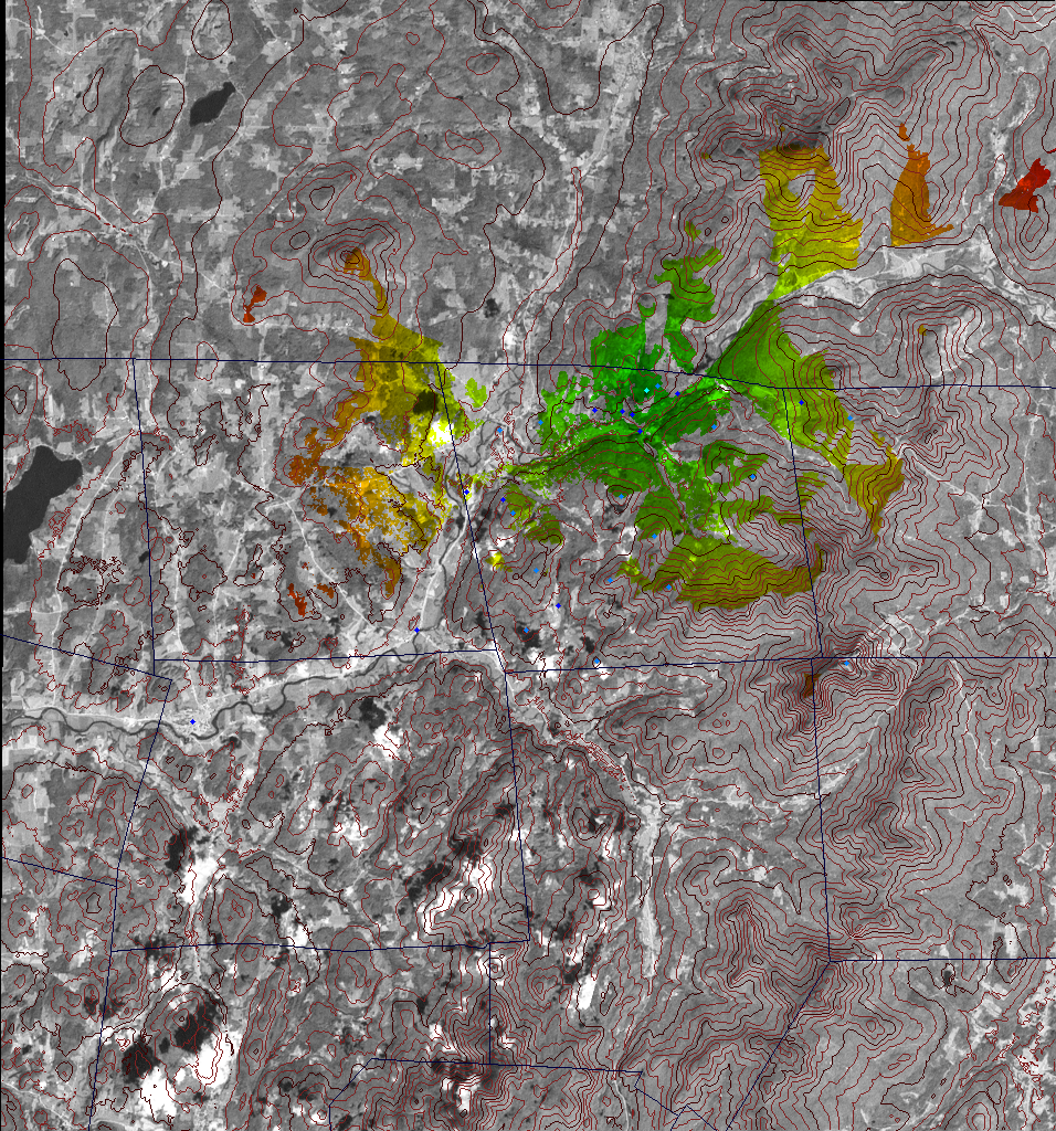
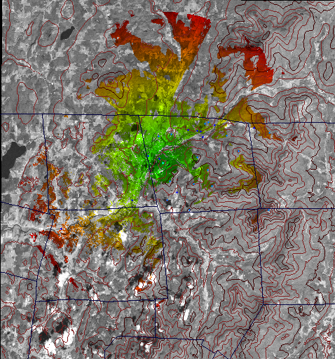
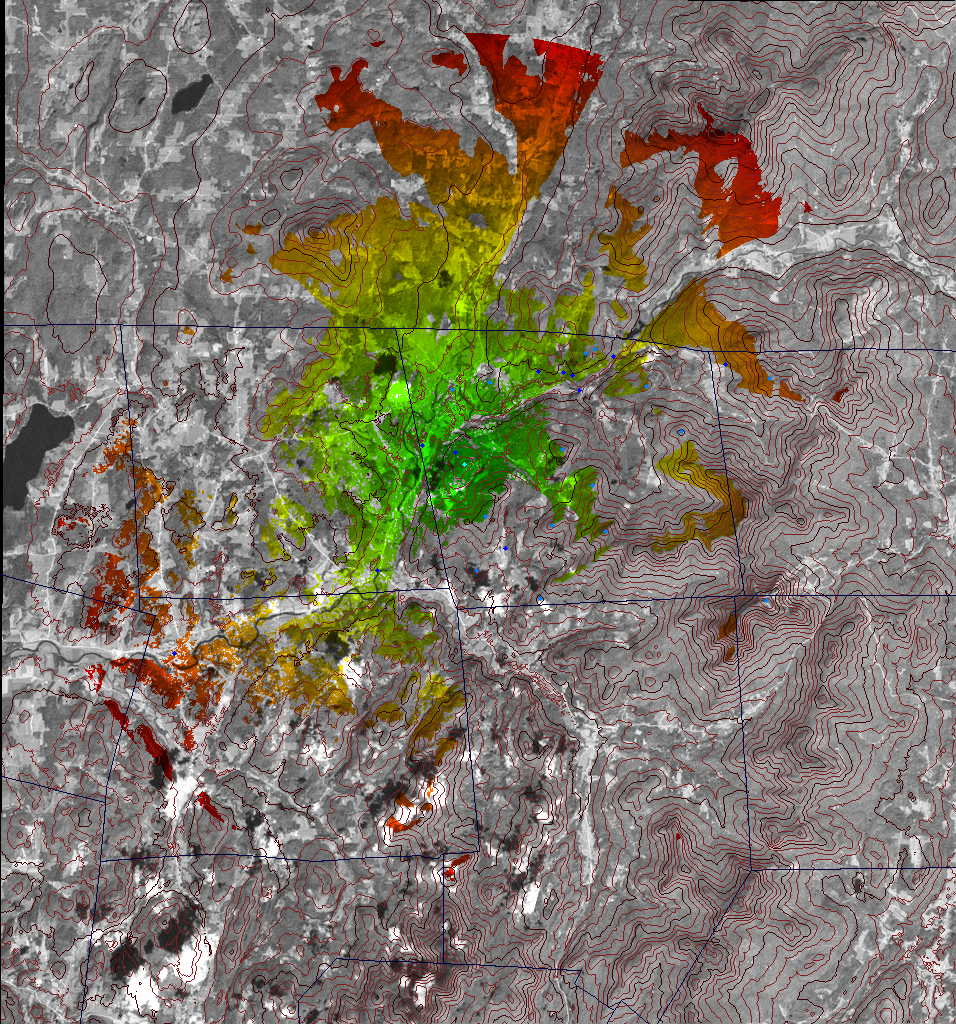
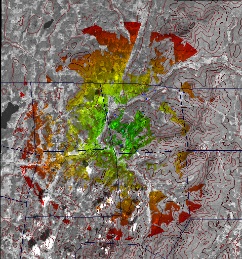
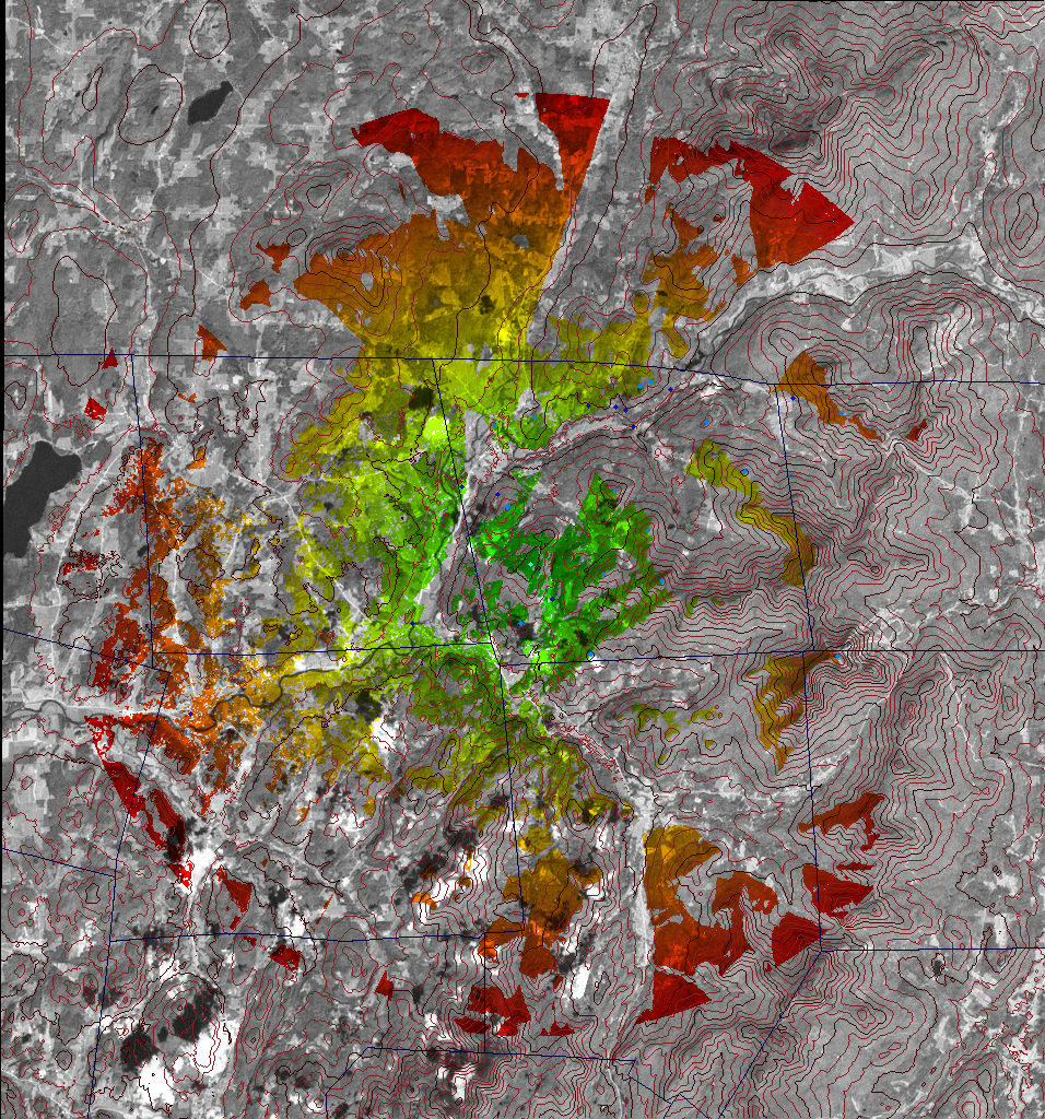
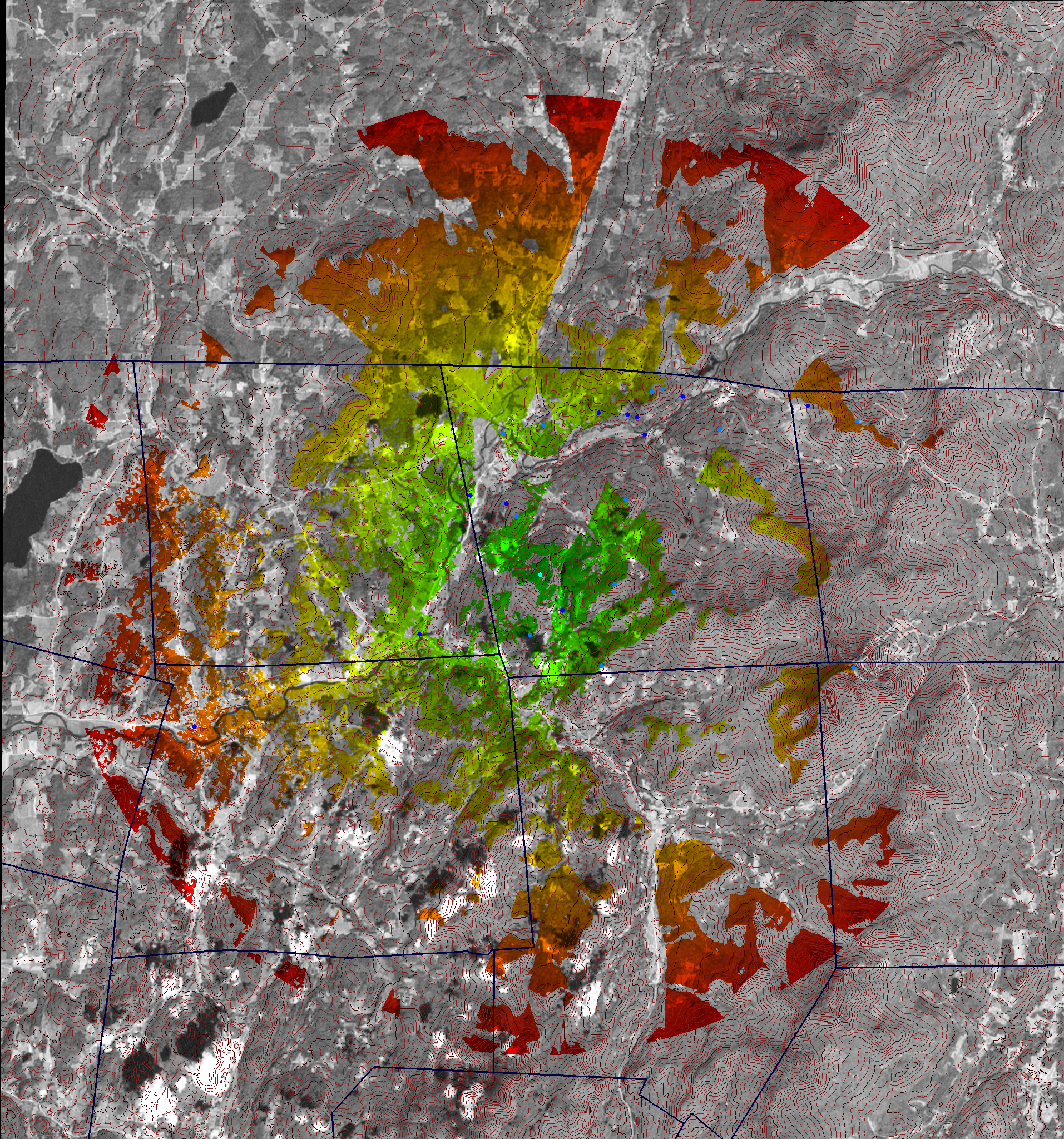
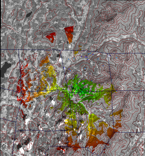
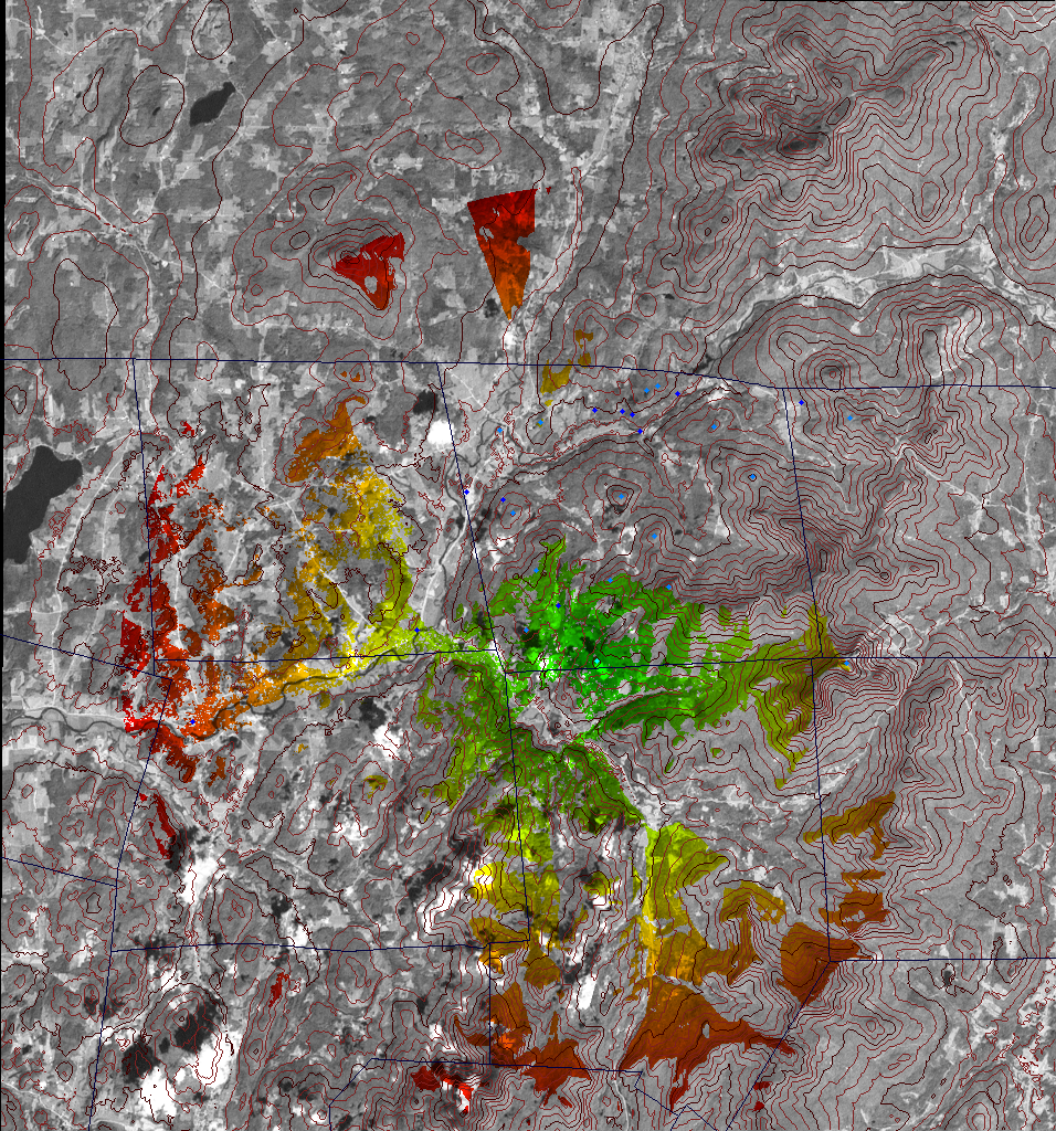
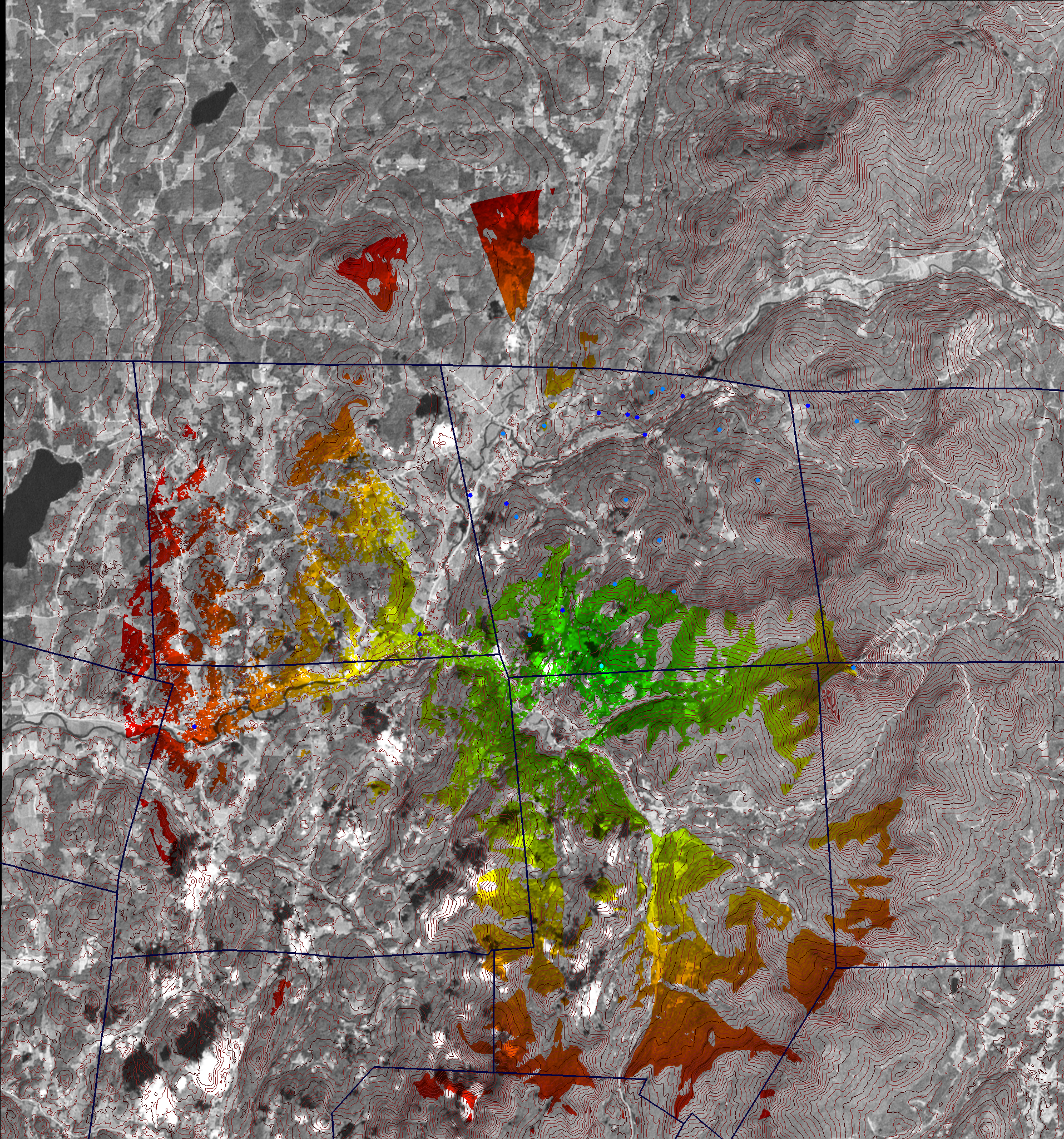
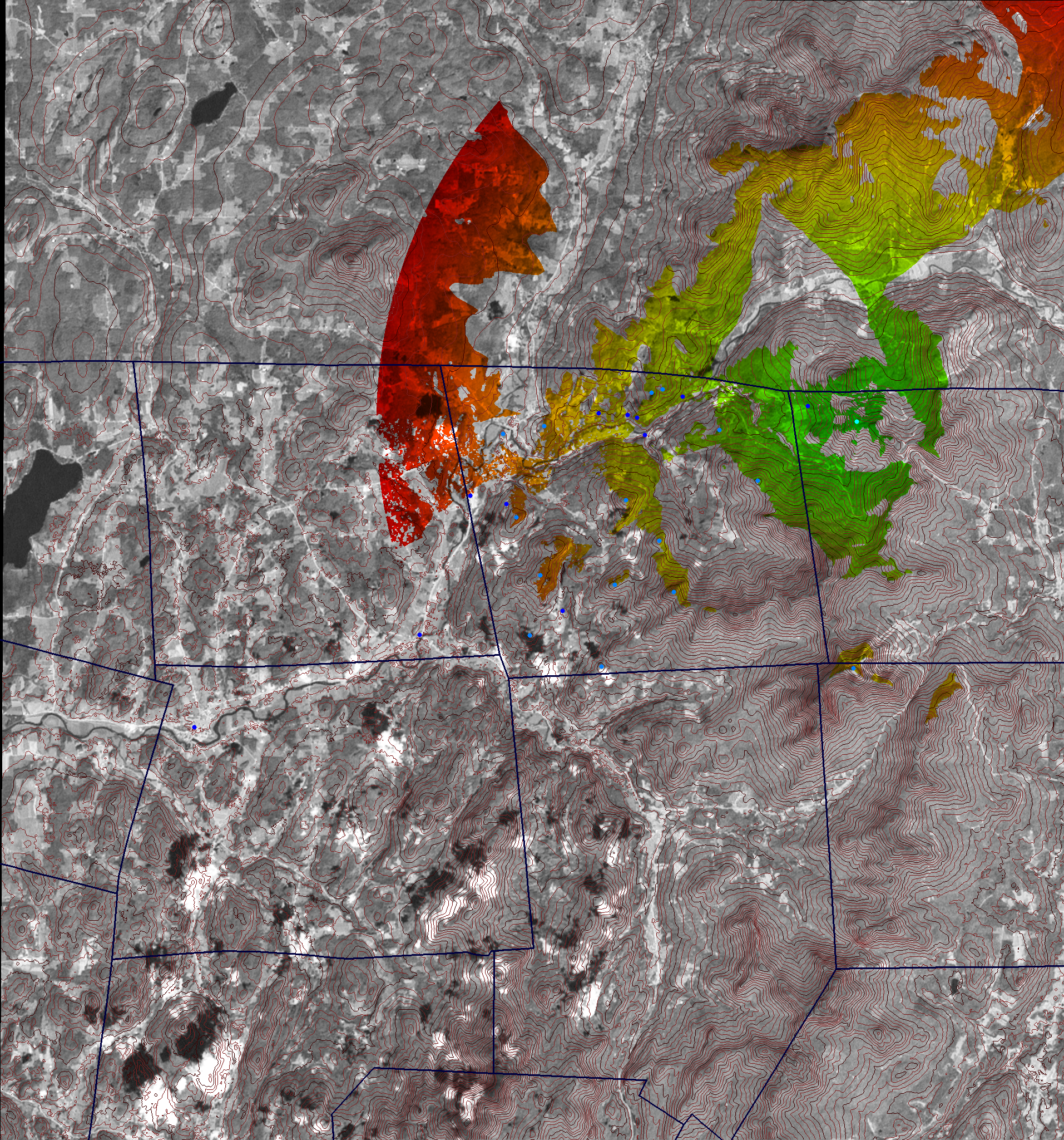
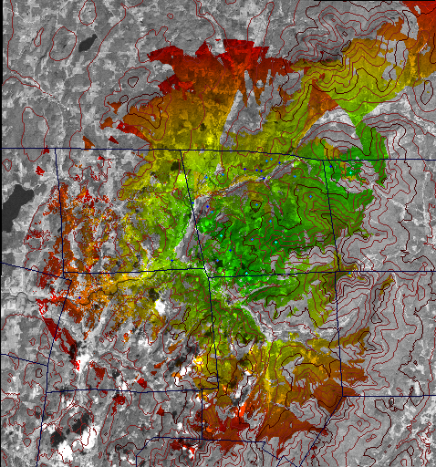
The program assumes the cell towers are 30 meters tall and that the cell phone is only one meter above the ground. The maximum range of the cell towers is set to 10 miles. The program can calculate the combined coverage for multiple cell towers. If a cell tower is included in a coverage chart then the tower is said to be "participating". Otherwise the tower is said to be "not participating". The charts are color-coded as follows:
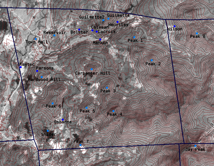
The following antenna sites were charted:
In addition there are Peaks 1-8 for other unnamed high points. The following 844x654 709KB chart has all the points labeled:
The charts were rendered in three sizes as follows:
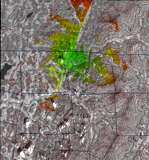
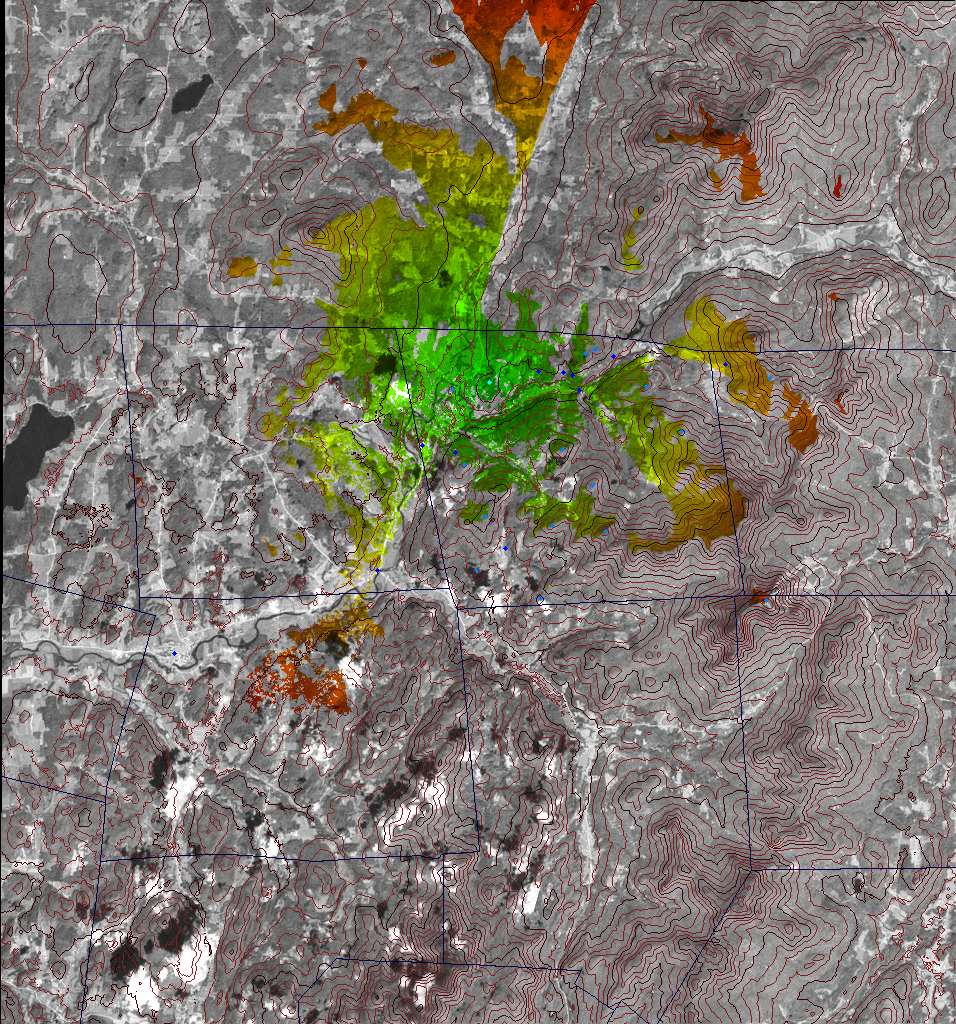
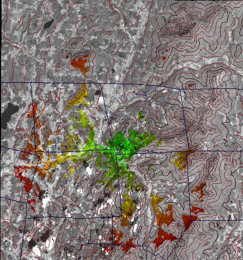
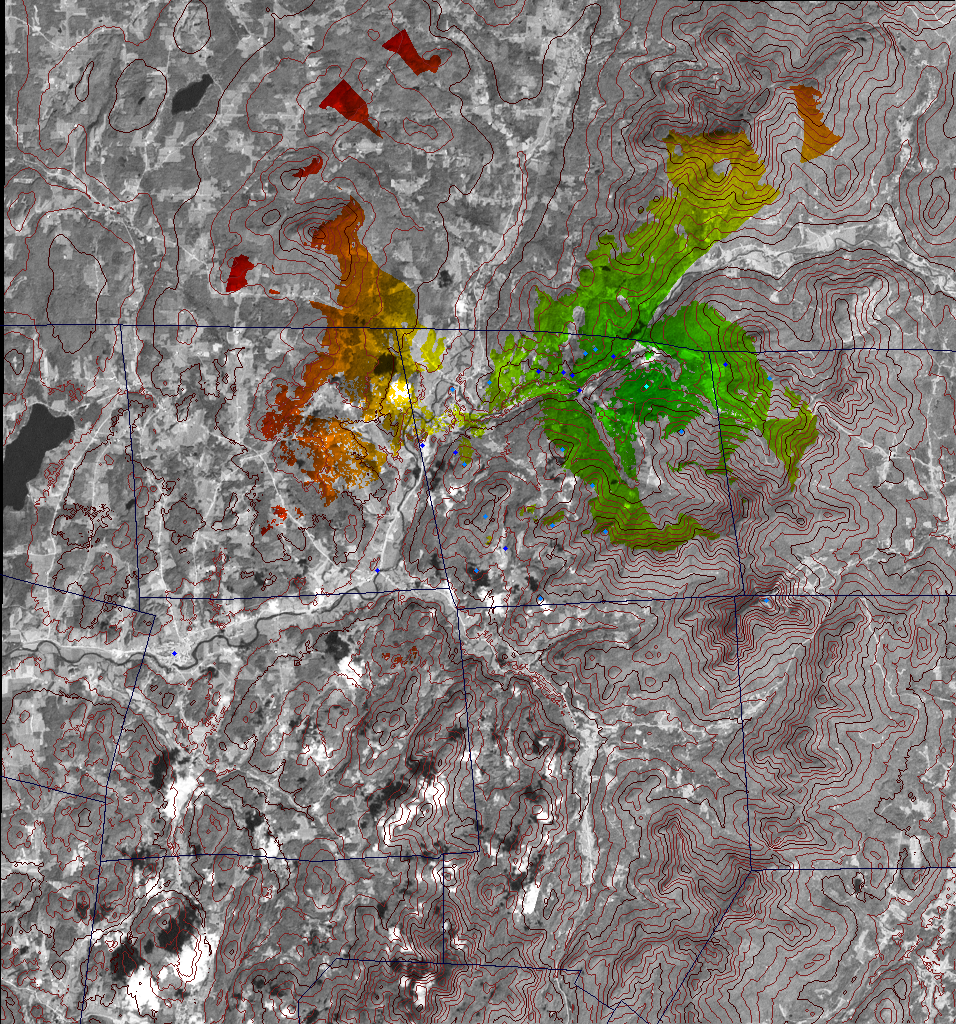
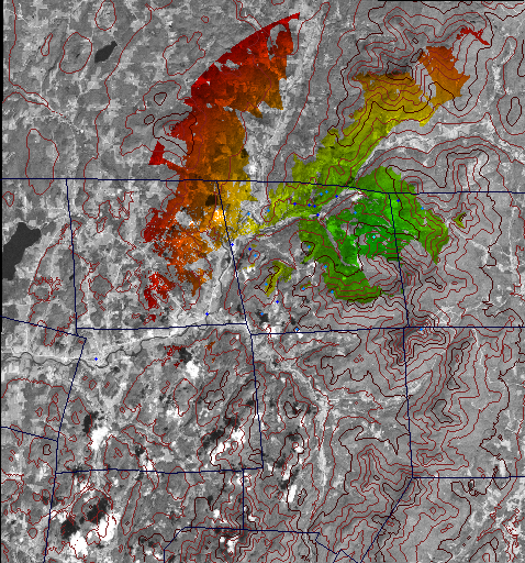
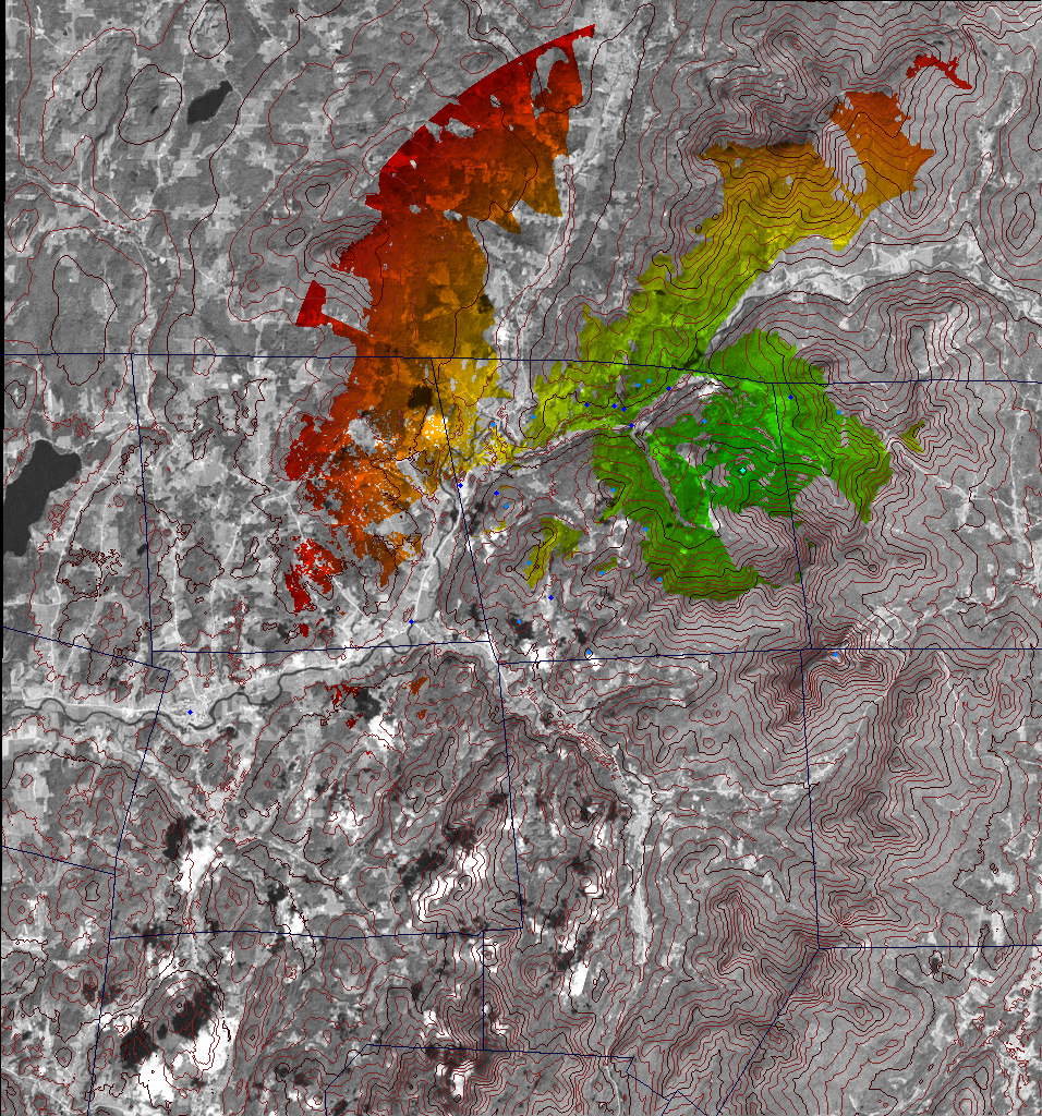
Single Site Charts
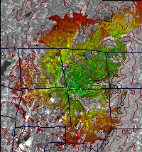
Multiple Site ChartsThe "Easy Four" chart shows the combined coverage for four antenna sites with existing access and/or power. Neither of these charts includes the current coverage from Jay Peak.
Updates:
2007-10-15: Added multiple antenna charts
Entire contents copyright © 2007, Richard Heurtley. All rights reserved. |

